
A number of evenings were spent on the computer with Anquet Maps producing a plan which involved sixteen days of walking over three weeks, this left us a day to travel down to Monmouth on the 9th May, 5 days walking, a rest day for emergencies or weather then move the caravans. Then we would undertake a further 5 days walking plus another rest day then 6 days walking to the finish and leave on the 30th May. The easiest day was eight and a half miles with 1400 feet of climb and the hardest, thirteen miles with 2800 feet of accent/descent.
What actually took place was that we went down on the 9th of May and pitched in very wet weather. The farmer found some duck boards for us to put outside the caravan to help prevent destroying the grass. The following morning we awoke to some evil weather. The drizzle and low cloud was drifting across the hills carried on a cold northerly wind, so much for the idea of having the weather on our backs. We put off starting for a while until the thought of using our first rest day on the first day was a bit embarrassing.
The section from Sedbury Cliffs to Monmouth follows the River Wye closely for most of the way high up above the steep slopes of its eastern, English side. The high route then follows the Dyke until this peters out at Redbrook. After that the path diverges further from the Wye and climbs the Kymin, rejoining the river at Monmouth. Most of this part of the path is within the Wye Valley Area of Outstanding Natural Beauty.
We finally moved out about 10.30 driving down to Bigswear Bridge to leave Ken’s car. After some trouble finding somewhere safe to leave the car, we drove to Sedbury Cliffs on the coast of the Bristol Channel, the start of the walk near Chepstow . By this time it had stopped raining but the same problem of parking occurred and was finally resolved by leaving Malcolm’s car in an old bus lay-by about half a mile from the path start. A quick look at the map told Malcolm that there was a footpath along the coast to the start point. So over the stile and down onto the sea marsh below the cliffs we went. What Malcolm had not realised immediately was that it was just after the full moon so the spring tides were running and the marsh was flooded and after about a quarter of a mile with the water very close to the top of our boots we decided to turn around and do the road walk to the start.
From the start of the walk we crossed the road down a field to our first obstacle , a raging torrent about 10 feet wide blocking the path with no sign of any method of crossing. We carried on walking up the field and found a section of broken down fence, which we climbed over onto a path which enabled us to double back to the correct point. The walk then takes you through the suburbs of Sedbury and Chepstow  Chepstow castle is situated on a narrow spur, the earliest parts date from 1067. We then began tackling the hills on the east bank of the River Wye.
 We found a lovely lunch stop with a fantastic view of the river although by now the rain had started again and would not let up for the rest of the day. The path is hilly and mainly in the trees thus in the prevailing conditions it was very wet and muddy but the weather did allow us to see a very misty view of Tintern Abbey as we slipped and slithered our way to Brockweir. At Brockweir there are two routes, over the hills or follow the river. During Malcolm’s planning sessions he had decided it would be nice to finish the first day with a three mile gentle stroll along the banks of the Wye with the early evening sunshine coming through the trees with their new foliage.
 How wrong can you be? Very muddy tracks, driving drizzle in our faces by the cold wind. We finally arrived at Bigsweir Bridge, drove back to collect Malcolm’s car and got back to the caravan at 20.00 hours.
 Then we had a shower, clean up, dinner, clear way then fell into bed after a very hard day. The GPS said we had walked 13.62 miles and climbed 2,200 feet.
We all slept well and the weather was very windy overnight.
We began walking by 10.30 from Bigsweir Bridge, with some steep climbs and descents still in clinging mud but at least the wind had cleared the rain. In the woods there were swathes of bluebells and many orchids.
 The flowers through the whole walk were a wonderful sight. We reached Redbrook and sat in the park by the river in the sunshine to have lunch. After lunch it was a two mile uphill grind to the battlemented Round House and Naval Temple, both built around the 1800’s. The path then goes steeply down into Monmouth where we arrived feeling strangely dressed walking down the main shopping street when all the schools were finishing. We walked through the 13th century gatehouse situated on the Monnow Bridge then on along Watery Lane and away over the hills again.
 The wind was now beginning to dry the mud so except for patches the walking was becoming easier under foot. Over another hill where we met a couple of fellow walkers who were wild camping the track northwards
This day we finished at Lower Hendre Farm where we had managed to park at the entrance to the Bridleway. The views were improving as the rain moved away but one disappointment of the whole walk was that it stayed hazy so we never saw the fantastic views that must be seen from this path.
We decided to use the available rest day to split the next day’s walk into two shorter days as we have friends in Monmouth who had arranged tickets to listen to a Welsh Male Voice Choir in Monmouth Parish Church on the Saturday night and also they had invited us all out for a meal on the Sunday night, both of which were very enjoyable.
The next 16 miles to Pandy are largely in the valley of the River Trothy, the country is pleasant though unexciting farmland. The villages and churches plus White Castle are the joys.
Today we walk from Lower Hendre Farm to White Castle in weather that was getting better as were the walking conditions in most places. White Castle dates back to the norman times and is the best preserved of the three castles namely White, Skenfirth and Grosmont. In the village of Llangattock Lingoed we came across the first of two village churches that had picnic tables in the churchyard and a kettle and drink facilities (tea and coffee only I am afraid) plus biscuits inside the church for the use of walkers for a small donation.
The next stretch of Offa’s Dyke Path is not through farmland and by rivers but on the Black Mountains. The route on the Hatterrall Ridge is in the main along the border of England and Wales and also on the eastern boundary of the Brecon Beacons National Park.
As we began tackling the Black Mountain section of the path a very kind farmer at Trewyn farm, near Pandy, allowed us to park a car in his farm yard for a £1 per day. Malcolm had decided that we would tackle the mountain section over two days, dropping off the ridge down into the Olchon Valley at the end of the first day. The car shunt on these two days was horrible, mile after mile of steep, high banked narrow Welsh roads.
Not long after leaving Trewyn Farm we leave the road to the open ridges and pass Pentwyn Iron Age Hill Fort. The immediate objective of the climb is the trig point at the first summit at 1,521 feet. The views into the two valleys at either side begin to open out and are seen to even better advantage near the summit of Hatterrall Hill itself at 1.743 feet. You then follow the English Welsh border as you gradually climb the long ridge leading from the top of Hatterrall Hill. A series of cairns begins to mark the route.You then reach another trig point at 2,010 feet. We then descend into the Olchon Valley.
That evening whilst looking at the map Malcolm had the idea that we could park at the picnic site at Little Black Hill and go over Black Hill before rising up to Hay Bluff. This was not quite Offa’s Dyke but did allow us to pull in another 2,000 footer and only cut out a mile or so of the official path that we could actually see during our ascent. What Malcolm did not know was that Ken suffers with vertigo so he found the very steep climb up Cats Back Ridge difficult in the wind. The guide book says it is a remarkably narrow ridge, which it is.
 The path is less than a couple of metres wide in places, dropping very steeply into the valley on both sides. The walk then took us over flag peat hags to Hay Bluff at 2,219 feet and the reward is a quite fantastic view north over Hay and the Wye Valley with the hills of South Radnorshire beyond, west are further Black Mountains edges and glimpses of the Brecon Beacons.
 We finally made it onto the wider part of the ridge and were then attacked by a series of hail storms sweeping across the hills. We can assure you that the trig point on Hay Bluff will shelter four people if they cuddle close and this is the end of the ridge on which we were walking. There is a steep drop off Hay Bluff down a gully to the Gospel Pass road. We had by then descended more than 600 feet in about half a mile and onto Hay-on-Wye where the Castle Car Park is actually on the path.
We then had a day off to move the caravans up to a very nice, small full facility site near New Radnor.
Today we park one of the cars at Gladstry a few miles from the Caravan Site and start the walk from Hay-on-Wye.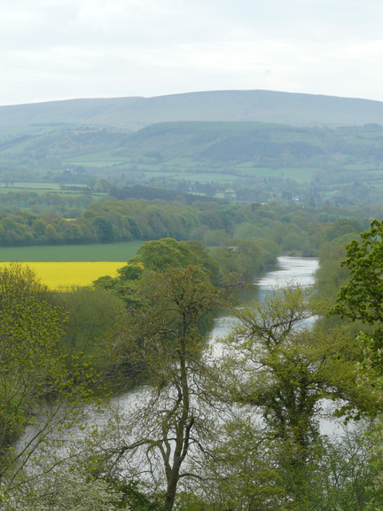
This section makes for very pleasant walking rising from the Wye Valley into the hills of Radnorshire, yet never far from the Border with Herefordshire. We follow the river for a couple of miles then there is a stiff pull up Bettws Dingle and over the hills to Newchurch where again there were drinks and biscuits available in the village church, then up Disgwylfa hill and onto Gladstry. Climbing these hills often only entails a hundred metres of climb but they tend to be very steep.
The following day leaving Gladstry we emerge onto the open moorland turf of Hergest ridge. This moorland section is nearly 3 miles long and you simply follow it over 1,300 feet enjoying the extensive views northwards , a ridge walk that was superb before dropping down into Kington. Here we cross the golf course on Bradnor Hill which is the highest in England rising to 1,284 feet and must be one of the most pleasantly situated of any.
 From Kington the chief feature here is your return to Offa’s Dyke after 54 miles, and we began to follow some of the well preserved stretches of the actual Dyke. The route is hilly but not unduly steep and the views are superb. Over Rushock Hill, contouring around Herrock Hill and crossing the Hinderwell Brook before taking a meandering course northwards to Discoed and the car.
The next day started with the obligatory two hundred metre climb onto Hawthorn Hill. The path passes a field containing an obelisk to Sir Richard Green Price who brought railways to Radnorshire. This is followed by a an undulating course and steep descent to emerge behind houses on the outskirts of Knighton where the Offa’s Dyke Centre is. We had lunch here before continuing on our route northwards. This was a lucky break because north of Knighton the hills trend west to east and are very steep. This is the toughest part of the whole route though you hardly go above 1,400 feet. The lie of the country is east-west so you follow a long procession of short steep climbs and descents and this section is known as the switchback from the early days of the path.
 That afternoon we did two of these climbs, one being Panpunton Hill that is steeper than it looks where at the top there is a seat dedicated to Frank Noble of the Offa’s Dyke Association and the cairn in memory of Roy Waters who did so much to pen the Path.
 The view below is largely of the Teme Valley, the feeling is of being on top of the world if you can see the view through the mist. Still climbing from the top of the hill at 1,343 feet the new views are of the Dyke going north over Llanfair Hill and of Kerry Hill ridge and Corndon Hill beyond, all pleasures to come, our day finished at Selley Hall. Just as we came through the outtake gate, the famer pulled up with his tractor just a bit lower down. As he dismounted he made a kind of hunting horn sound with his voice and all the sheep behind us on the hillside rushed down to the gate we had just shut. This was a good timing on our behalf as the path was very muddy, very steep with a sheer drop on one side and gorse bushes on the other, so there would have been no escape from the stampede.
 Whilst talking to the farmer he said, if you want to take pictures go down to near the tractor because when I open the gate there will be a stampede. There was, as the sheep all rushed to the feed he had put in the troughs on the yard, you could feel the ground shake. We called into the Offa’s Dyke Centre on the way back and were disappointed as it seemed very run down.
By now we were getting fitter but this day was a very hard 12 mile day with 2800 feet of climbing and as I have written we did two of the switchbacks the previous day thus cutting down on the climbing and distance . We now climb to the top of Edenhope Hill and we have now covered half of the walk. It is 1 ¼ miles and a drop 600 feet to Mellington and the start of the Montgomery Plain.
 The next stretch is through the grounds of Millington Hall built in 1876 in Victorian industrialists Gothic style and now a hotel and an extensive caravan, park through arched gateway to the Brompton Crossroads where the car is parked.
The Brompton Crossroads to Buttington section started off very nicely with a pleasant, roughly five mile gently undulating walk along the Dyke in a north north-westerly direction to cross the A490 road at Forden. The route takes the walker over a flat stretch, the valleys of the Caebitra and Camlad, surrounded by hills: Kerry Hill ridge to the south and Town Hill, Montgomery to the west. Flat farmland it may be but the distant views are memorable because these prominent shapes are to be seen from considerable distances to both north and south of the route.
 There is then a penalty to pay, 2000 feet of climbing in six and a half miles all in the afternoon.
By this time we were nearing the end of the second week and still had a built in rest day in hand so we decided to carry on walking and get the next section under our belts. The weather was now very hot indeed and this was to be the case for the rest of the walk. It was also one of the easiest as although it was a good distance there was not much climbing. This did involve our biggest daily car shunt as we drove ninety eight miles that day as well as the walk. The dull bit is a common, but unfair description of this stretch of Path between Buttington and Llanymynech initially following the bank of the River Severn and then the part restored Montgomery Canal. After joining the canal Pool Quay lock and the 1820’s lock-keeper’s cottage make a good coffee stop. This is a branch of the Shropshire Union Canal and forms two short sections of the Path south of Pool Quay and north of Four Crosses.
 It was part of a scheme to link the Severn Valley as far as Newtown with the Dee and Mersey. Bird life was in abundance.
Another semi rest day whilst we moved the vans to Bathafarn Hall a small minimum facility site near Ruthin.
The Heritage Centre car park on the canal at 220 feet in Llanymynech leads the Offa’s Dyke walker straight up the hill next morning to 740 feet following the Dyke on its tortuous route northwards. We pass below old quarries and kilns and gradually swing north under the prominent shoulder of Asterley Rocks This section includes going over the old Oswestry Racecourse which was gorgeous with rivers of bluebells
 and now the summer flowers were coming out. Part of the track is still visible and some of the scattered cottages and the remains of the grandstand date from its heyday in the early 18th to 19th centuries. There is a panorama from the top at 971 feet and the views were good but they could have been super if it had not been so hazy.
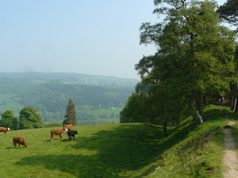
From Craignant where we parked at a picnic spot in a very steep narrow valley where we start the walk passing old kilns, the path leading over the hills, descending into the Ceiriog Valley where Chirk Castle looms ever larger and to the east the viaduct and aqueduct in Chirk are clearly visible. On arrival at Chirk Castle we stopped for a break.
 This was one of the few places on route where you could buy cool drinks as by now the weather was very hot. We were carrying 2 litres each of liquid and freezing our water bottles overnight. Christine and Malcolm drank a litre of milk from the café and we emptied two bottles of pure orange juice that went down a treat.
Onwards over the hills before dropping down to Pentre where we joined the towpath of the Llangollen Canal for a couple of miles before crossing the 120 foot high Pont Cysyllte canal aqueduct a wonder of its age in 1805 . Again Ken found the exposure here difficult to contend with but was determined to walk across. The seats and benches at the north end of the Aqueduct made a very comfy lunch stop. After another short stretch along the canal it was upwards again onto the side of Eglwyseg Mountain.
 The first part of the climb is through gloomy conifers but it gradually opens out until we were following the woodland edge. When open moorland is reached the path then climbs up to the road. A beautiful part of the walk the cliffs of Creigiau-Eglwyseg rearing up on our right , Castell Dinas Bran
the isolated hilltop Iron Age hill fort in front and the views down and across the Llangollen Valley was superb.
The start of the next day was from World’s Endand this section was across the moor on board walks and then a drop down through the Llandegla Forest where we had some shade from the very hot sun. We reached the village of Llandegla where they were putting out the bunting – not for us but for the Diamond Jubilee. We finished this day where the path crosses the A494 road making this days car shunt one of the shortest as we finished only about two miles from the caravans so only had to collect the other car.
Two days to go. This was in Malcolm’s view the best day, but we found this very hard with the combination of the very intense heat, no cover and a lot of steep climbs. This is an exhilarating moorland walk along a range of rounded hills with fine Iron Age forts and even more striking views from Snowdon to Cheshire. From the A494 we climb Moel Eithinen then down to Bwlch Penberras before a long steady climb up to the Jubilee Tower on Moel Famau. Built to celebrate the Jubilee of George III but never completed.
 Not high in mountain terms at 1,820 feet but with spectacular views of Snowdonia, The Great Orme and Anglesey to the west and out over the Cheshire Plain and Liverpool to the east. From the summit the path goes steeply downhill and from here you can see the defensive rings of the hill fort of Moel y Gaer below. This was followed by a switchback ridge with an old Hill Fort on every summit surrounded by its defensive ditches and ramparts. The path now descends to Bodfari, falling more than 1,300 feet in less than 3 miles. This day finished in the village of Bodfari.
The last walking day. Were we pleased? We were quite sad as we did not want it to end in one way, but were pleased to be near completing it as well . The newly opened Welsh Coast Path beckons. What a pity the north end is so boring, this is sometimes said by those planning to walk the Path, but wrongly as we found it to some extent. Offa’s Dyke path doesn’t give up quietly. It involves almost 12 ½ miles of walking plus almost 2,620 feet of climbing before we walk down the main shopping street of Prestatyn and stare at the foot bridge over the railway thinking we cannot make it over that. Before that a good supply of energy and navigational skills is needed as we set off from Bodfari. The Path climbs up the very steep minor road going west and continues to climb. From the viewpoint west is the Vale of Clwyd and if the weather is clear Snowdonia and the sea. We climb round the slopes of Moel Maenefa.
 Having passed through Rhuallt we go north and climb steeply through a patch of woodland and by gorse clumps. This slope of Mynydd y Cwm proves that the Clwyds have not yet finished with us.
 Finally we reach the Sea front, have our photo taken by the signpost saying Chepstow 182 miles, take our boots off and have a paddle in the sea. After that we treated ourselves to fish, chips and peas in the Offa’s Dyke Restaurant on the esplanade. The best fish and chips, if you could call them chips, more like wedges that we have had in a long time.
A super walk, here’s to the next one.
To summarise, a very well marked track. We walked 182 miles in sixteen days and climbed a total of 33933 feet or roughly Mount Everest plus Ben Nevis together both from sea level. The guide book states 700 stiles but many have now been replaced with kissing gates so we believe there are now only between 200 and 300. Using the two caravans and two cars was a cheaper way of walking the path, although making the days longer and required a lot more planning than backpacking or using a company. If we were going to do it again, we would put in two more caravan moves to make the car shunts shorter.
We still cannot believe that buying two books, moving house and meeting new neighbours who love walking would lead to three fabulous weeks of wonderful scenery, good company and fantastic weather, only one wet day, two cold but sunny days and the rest hot in a year when there has been so much bad weather. We obviously decided to retire at the right time, although it is proving to be an adventure. Christine Clough has also proved that having two hip replacements does not stop you from doing long distance walks and we are still all four talking to one another.
Christine and Ken Levasseur
Amber Valley Ramblers